

Image: © GEBCO
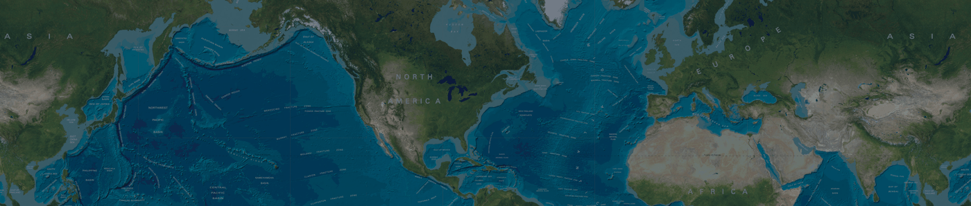
The latest release of the GEBCO 30 arc-second global grid of elevations, GEBCO_2014 Grid, was published in 2014. It provides an update to the previous release, GEBCO_08 Grid.
It was largely generated by combining quality-controlled ship depth soundings with interpolation between sounding points guided by satellite-derived gravity data. Where they improve on the existing grid, data sets developed by other methods are included to create a continuous terrain model for ocean and land.
The GEBCO_2014 Grid is accompanied by a Source Identifier (SID) Grid. This identifies which cells are based on actual depth values and which contain predicted depth values.
For more information about the development of the grids and their data sources please see the data set documentation, provided through the British Oceanographic Data Centre (BODC) web site. Users are strongly advised to read this before making use of the data set.
Access a paper about the GEBCO_2014 Grid in Earth and Space Science, 2, doi:10.1002/2015EA000107
If the data sets are used in a presentation or publication then we ask that you acknowledge the source. This should be of the form (including the appropriate version number)
For the GEBCO_2014 Grid
“The GEBCO_2014 Grid, version 20150318, www.gebco.net”
For the GEBCO_2014 SID Grid
“The GEBCO_2014 SID Grid, version 20150318, www.gebco.net”
The version number of the grid is given in the header information within the grid file.
The table below describes the updates included in various releases of GEBCO's global 30 arc-second bathymetric grid. Version numbers are representative of the release date of the data set, i.e. year, month, day.
| Grid name (version) |
Update(s) | Release date |
|---|---|---|
| GEBCO_2014
(20150318) |
Southern Ocean (south of 60°S) — International Bathymetric Chart of the Southern Ocean (IBCSO).
In version 20141103 of GEBCO_2014, there is a 500m (approximate) shift in latitude northwards of the data set compared to the source IBCSO grid in the region south of 60°S. This error appears to have occurred during the process to include the IBCSO grid into GEBCO. This error has now been corrected and the area south of 60°S has now been replaced in GEBCO_2014 with a re-processed version of the IBCSO grid. |
2015-03-25 |
| GEBCO_2014
(20141103) |
|
2014-12-01 |
| GEBCO_08 (20100927) |
|
2010-09-27 |
| GEBCO_08 (20091120) |
Inclusion of version 2.23 of the International Bathymetric Chart of the Arctic Ocean (IBCAO) for the region 64N-90N; 180W-180E | 2009-11-24 |
| GEBCO_08 (20090202) |
Updated release of the GEBCO_08 Grid due to minor bug fixes | 2009-02-02 |
| GEBCO_08 (20090130) |
First release of the GEBCO_08 Grid | 2009-01-30 |
The data are made available in netCDF, Esri ASCII raster and INT16 data GeoTiff formats.
In netCDF format, the data are available in the form of both two-dimensional (2D) and one-dimensional (1D) arrays of signed 2-byte integers. The 2D gridded data set uses the netCDF Climate and Forecast (CF) Metadata Convention. The 1D array grids are, primarily, for use with GEBCO's Grid Display software and GEBCO Digital Atlas (GDA) software packages and so are only available as a global grid.
This is an ASCII format developed for the export/exchange of Esri ARC/INFO rasters. The format consists of a header that gives the geographic extent and grid interval of the data set, followed by the actual grid cell data values.
The GeoTiff format contains geo-referencing (geographic extent and projection) information embedded within a Tiff file. The GEBCO_2014 Grid and SID grids are made available as single-channel INT16 (two byte signed integer) data values for user-defined areas in GeoTiff format.
Find out more about the file formats and use of the data in some external software packages.
Data values within GEBCO's global terrain models represent elevation in metres, with negative values for bathymetric depths and positive values for topographic heights.
Within the Source Identifier (SID) grid data values are coded as follows:
| SID file coding | Description |
|---|---|
| -8888 | The grid value at this location has a positive (+ve) value , i.e. is coded as land. Note: the Southern Ocean region (south of 60°S) is based on the IBCSO. Here elevation values are based on the Bedmap2 data set and are therefore encoded as 3500. |
| 0 | The grid value at this location has been developed from a database of ship-track soundings with interpolation between soundings guided by satellite-derived gravity data. At this location in the grid, the data value has been interpolated. |
| 110 | The grid value at this location is taken from the Caspian Sea grid. This grid has been generated from a data set of soundings using a kriging gridding algorithm. SID grid cells that contain a sounding(s) from the Caspian Sea source data set are coded as ‘1100’. |
| 120 | The grid value at this location is taken from the Black Sea grid. This grid has been generated from a data set of soundings using a kriging gridding algorithm.
SID grid cells that contain a sounding(s) from the Black Sea source data set are coded as ‘1200’. |
| 130 | The grid value at this location is taken from the GEBCO_08 Grid. In this region, the GEBCO_08 Grid is based on the Weddell Sea grid, (see Annex B.3). This grid has been generated from a data set of bathymetric contours based largely on multi-beam and single beam bathymetric surveys.
SID grid cells which contain trackline control from the Weddell Sea source data set are coded as ‘1300’. |
| 1100 | The grid value at this location is taken from the Caspian Sea grid. The grid cell at this location contains a sounding(s) from the Caspian Sea source data set.
For the Caspian Sea grid, cells that do not contain a sounding(s) are coded as ‘110’. |
| 1200 | The grid value at this location is taken from the Black Sea grid. The grid cell at this location contains a sounding(s) from the Black Sea source data set.
For the Black Sea grid, cells that do not contain a sounding(s) are coded as ‘120’. |
| 1300 | The grid value at this location is taken from the GEBCO_08 Grid. In this area the GEBCO_08 Grid is based on the Weddell Sea grid. This grid has been generated from a data set of bathymetric contours based largely on multi-beam and single beam bathymetric surveys.
The grid cell at this location is ‘crossed’ by trackline control information, i.e. survey track or isolated sounding, from the Weddell Sea source data set. For the Weddell Sea grid, cells which do not contain trackline control are coded as ‘130’. |
| 1400 | The grid value at this location is taken from the Geoscience Australia grid 'Australian Bathymetry and Topography Grid, June 2009'. |
| 1500 | The grid value at this location is based on ENC soundings supplied by the East Asia Hydrographic Commission. |
| 1550 | The grid value at this location is based on ENC bathymetric contours supplied by the East Asia Hydrographic Commission. |
| 1600 | The grid value at this location is based on gridded data from the North American Great Lakes gridded data sets. |
| 1700 | The grid value at this location is based on gridded data from the Gulf of Cadiz gridded data set “The quest for the 'Africa–Eurasia plate boundary west of the Strait of Gibraltar'. |
| 1800 | The grid value at this location is based on multibeam data from the 2004 cruise of HMS Scott. |
| 1900 | The grid value at this location is taken from the IBCAO V3 grid (www.ibcao.org) and is based on interpolation. |
| 1910 | The grid value at this location is based on multibeam data in the IBCAO V3 or IBCSO V1 grids. |
| 1920 | The grid value at this location is based on single beam data in the IBCAO V3 or IBCSO V1 grids. |
| 1940 | The grid value at this location is taken from either the IBCAO V3 or IBCSO V1 grids and is based on depth data from digital bathymetric models. |
| 1950 | The grid value at this location is taken from the IBCAO V3 and is based on depth contours from digitised charts. |
| 2000 | The grid value at this location is based on Olex data. |
| 2100 | The grid value at this location is based on interpolation using an adjustable tension continuous curvature surface gridding algorithm 'surface' from GMT. |
| 2200 | The grid value at this location is based on data from the Lamont-Doherty Earth Observatory (LDEO) of Columbia University, Global Multi-Resolution Topography Synthesis. |
| 2300 | The grid value at this location is based on a gridded bathymetric data set for Irish designated waters, based on multibeam surveys, provided by the Geological Survey of Ireland. |
| 3100 | The grid value at this location is taken from the IBCSO V1 grid and is based on data from nautical charts. |
| 3200 | The grid value at this location is taken from the IBCSO V1 grid and is based on steering points. |
| 3300 | The grid value at this location is taken from the IBCSO V1 grid and is based on interpolation. |
| 3400 |
The grid value at this location is taken from the IBCSO V1 grid and is based on data from the GEBCO_08 Grid. At this location, the GEBCO_08 is based on interpolation guided by satellite-derived gravity data. |
| 3450 | The grid value at this location is taken from the IBCSO V1 grid and is based on data from the GEBCO_08 Grid. At this location, the GEBCO_08 is based on trackline sounding data. |
| 3500 | The grid value at this location is taken from the IBCSO V1 grid and is based on data from the Bedmap2 data set. |
| 3600 | The grid value at this location is taken from the IBCSO V1 grid and is based on other grids and data sets. |
| 3700 | The grid value at this location is based on control contours used to help constrain the grid interpolation process using GMT’s 'surface' gridding algorithm. |
| 3800 | The grid value at this location is based on data from EMODnet 2013 |
| 3900 | The grid value at this location is taken from the Baltic Sea Bathymetric Database grid |
| 4000 | The grid value at this location is based on the GEBCO One Minute Grid |
| 4100 | The grid value at this location is based on bathymetric contours from the Centenary Edition of the GEBCO Digital Atlas |
| 4200 | The grid value at this location is based on bathymetric contours from the International Bathymetric Chart of the Mediterranean (IBCM) |
| 4300 | The grid value at this location is based on multibeam data from RRS Charles Darwin cruise CD118 |
| 4400 | The grid value at this location is based on ENC soundings provided by the Servicio Hidrográfico y Oceanográfico de la Armada de Chile |
| 4500 | The grid value at this location is based on the Japan Coast Guard grid and in this region the grid is based on multibeam data |
| 4550 | The grid value at this location is based on the Japan Coast Guard grid and in this region the grid is based on the J-EGG500 grid JODC-Expert Grid data for Geographic -500m |
| 9999 | The grid value at this location has been developed from a database of ship-track soundings with interpolation between soundings guided by satellite-derived gravity data. At this location, the grid cell has been constrained by bathymetric sounding(s) data during the gridding process. |
Although every effort has been made to reduce the number of errors in the data set, we expect that some grid artifacts will be found. See the errata pages, hosted on BODC's web site, for a list of reported bugs.
If you find any unreported bugs in the grid please report them via e-mail, in the first instance to Pauline Weatherall, the GEBCO Digital Atlas Manager, at BODC.