
Maps of world ocean bathymetry
- GEBCO world map
- International Bathymetric Chart of the Arctic Ocean (IBCAO)
- International Bathymetric Chart of the Southern Ocean (IBCSO)
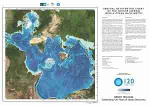
GEBCO world map
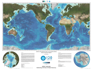
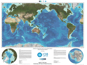
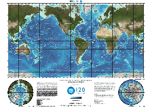
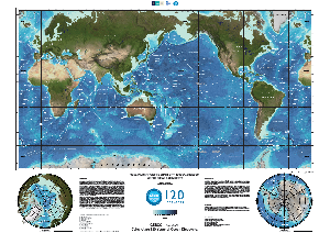
The GEBCO world map shows the bathymetry of the world's ocean floor in the form of a shaded relief colour map. The imagery is based on the 2022 release of the GEBCO global grid.
Two versions of the maps are made available, one with and one without undersea feature names.
Please note that because of the size of the files we recommend that they are saved to disk rather than opened from the links below.
Without undersea feature names
|
Image:
| A0 size (841 x 1189 mm), centred at 90W Image:
(572 Mbytes) | A2 size (420 x 594 mm), centred at 90W Image:
(187 Mbytes) |
|
Image:
| A0 size (841 x 1189 mm), centred at 150E Image:
(572 Mbytes) | A2 size (420 x 594 mm), centred at 150E Image:
(187 Mbytes) |
With undersea feature names
These map images include undersea feature names.
International Bathymetric Chart of the Arctic Ocean (IBCAO)
The aim of the IBCAO initiative is to develop a digital database containing all available bathymetric data north of 64° North, for use by mapmakers, researchers, institutions and others whose work requires a detailed and accurate knowledge of the depth and the shape of the Arctic seabed.
Download the IBCAO map as a PDF file (230 Mbytes)
Please note as the file is large we recommend you right-click and save it rather than opening the link.
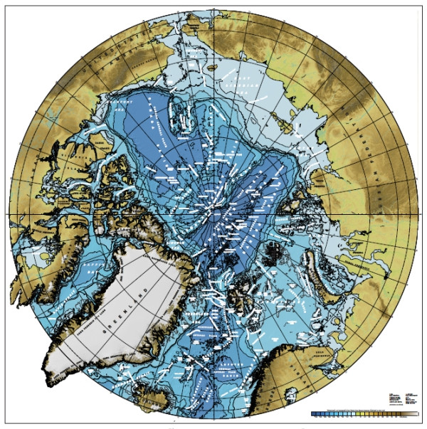
The map is based on the IBCAO Version 3.0 gridded digital bathymetric model. It has a scale of 1:6 000 000 and is based on a polar stereographic projection with standard parallel at 75°N.
The gridding compilation methods along with details of the bathymetric source data are described in Jakobsson et al. 2012. The bathymetric source data used in the construction of IBCAO Version 3.0 grid consist of historic and recent under-ice soundings collected by submarines of the United States and the United Kingdom, historic and recent observations collected on icebreakers and ice camps and information portrayed in published navigation and compilation charts.
International Bathymetric Chart of the Southern Ocean (IBCSO)
The objective of the IBCSO program is to gain better knowledge of the sea floor topography in the Southern Ocean. To achieve this, the IBCSO group collects and compiles bathymetric data from hydrographic offices, scientific institutions and data centres to create the first regional digital bathymetric model that covers all circum-Antarctic waters.
The digital version of the IBCSO V2 map is available for download at the PANGAEA web site.
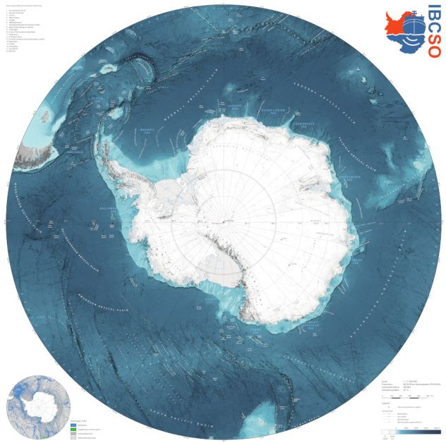
It has a scale of 1:11 500 000 and uses IBCSO Polar Stereographic projection EPSG:9354.
The IBCSO digital printable chart is based on the IBCSO version 2.0 digital bathymetric model.