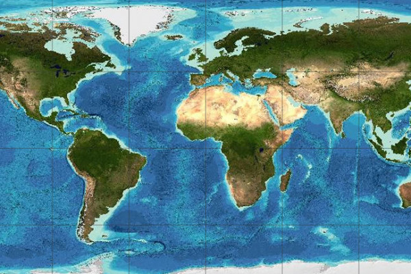
Gridded Bathymetry Data
GEBCO's gridded bathymetric data sets are global terrain models for ocean and land. The grids are available to download or access through Web Map Services.
Data & Products
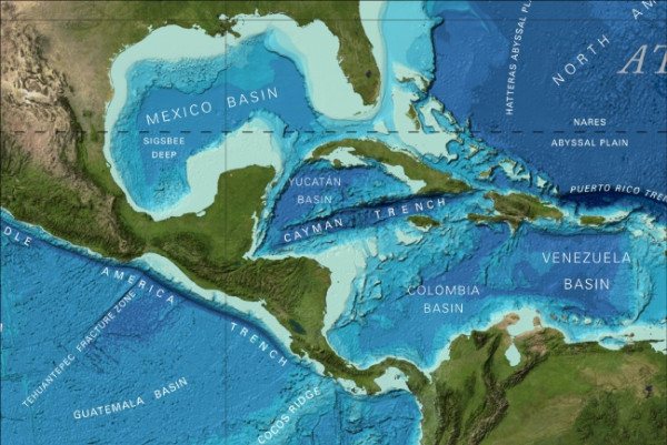
GEBCO produces and makes available a range of bathymetric data sets and products. This includes a global bathymetric grid; gazetteer of undersea feature names, a Web Map Service and printable maps of ocean bathymetry.
Seabed 2030
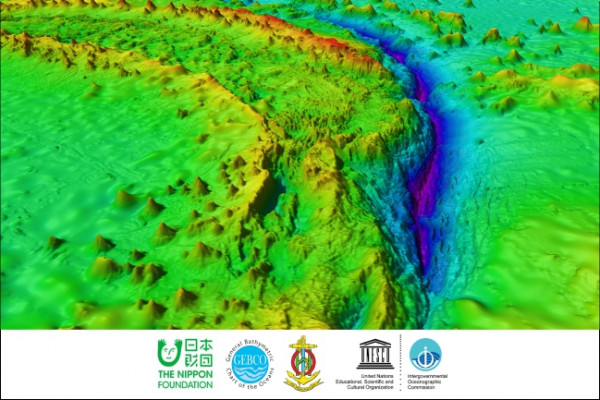
Seabed 2030 is a collaborative project between the Nippon Foundation and GEBCO. It aims to bring together all available bathymetric data to produce the definitive map of the world ocean floor by 2030 and make it available to all.
GEBCO_2025 Grid now available
The 2025 release of the global GEBCO bathymetric grid is now available.
Latest news

Ocean Floor Explore - A Map the Gaps Symposium


Crowdsourced Bathymetry Tools Workshop

IBCAO Version 5 Release Paper
General Bathymetric Chart of the Oceans
Producing free, open and complete seabed data and information for the world’s oceans.
Some of our People

Mr Evert Flier

Prof Martin Jakobsson

Dr Vicki Ferrini

Dr Rochelle Wigley