
Main navigation

  • Home
  • Data & Products
    • Gridded Bathymetry Data
      • Regional grid - Arctic Ocean (IBCAO)
      • Regional grid - Southern Ocean (IBCSO)
      • Errata and known issues
      • GEBCO_2025 Grid
      • GEBCO_2024 Grid
      • GEBCO_2023 Grid
      • GEBCO_2022 Grid
      • GEBCO_2021 Grid
      • GEBCO_2020 Grid
      • GEBCO_2019 Grid
    • Undersea Feature Names
    • GEBCO Web Services
      • Web Map Service
      • Previous GEBCO WMS
    • Printable Maps
    • IHO-IOC GEBCO Cook Book
    • Historical GEBCO Charts
    • Historical Data Sets
    • Imagery
    • History of GEBCO
  • Seabed 2030
  • Training
  • News & Media
  • About
    • Overview
    • GEBCO Strategy
    • Project History
    • Seabed 2030
    • Acknowledgements
      • Our Data Contributors
      • Working With Industry
    • Contributing Data
    • Presentations and Publications
    • Committees and Groups
      • Guiding Committee
      • Regional Mapping
      • Undersea Features Names
      • Technical Mapping
      • Communication and Outreach
    • Meetings and Minutes
    • GEBCO Symposium
    • Frequently Asked Questions
    • Useful links
  • Contact
Search
IHO Logo
Combined IOC and UNESCO logo
GEBCO logo
GEBCO logo
GEBCO
General Bathymetric Chart of the Oceans
  1. Home
  2. News

Ocean Floor Explore - A Map the Gaps Symposium

8 August 2025
Image:
Map the Gaps Symposium

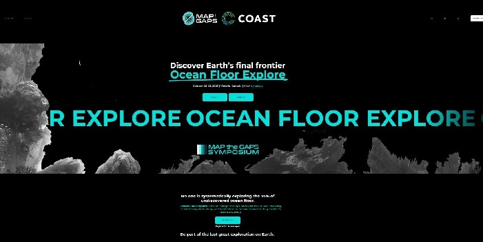
Find out more about the Ocean Floor Explore event to be held in Victoria, Canada, 26-29 October 2025. 

Ocean Floor Explore aims to bring together leaders in blue investing, philanthropy, technology, and exploration to pioneer a new funding model for ocean discovery to help systematically explore the 75% of undiscovered ocean floor.


Image:
Ocean Floor Explore 2025


Share this content

  • facebook
  • twitter
  • linkedin
  • email
BODC logo

Copyright © 2020-2025, GEBCO

Hosted by the British Oceanographic Data Centre (BODC)

Footer menu

  • Privacy Policy
  • Disclaimer
  • Home
  • Data & Products
    • Gridded Bathymetry Data
      • Regional grid - Arctic Ocean (IBCAO)
      • Regional grid - Southern Ocean (IBCSO)
      • Errata and known issues
      • GEBCO_2025 Grid
      • GEBCO_2024 Grid
      • GEBCO_2023 Grid
      • GEBCO_2022 Grid
      • GEBCO_2021 Grid
      • GEBCO_2020 Grid
      • GEBCO_2019 Grid
    • Undersea Feature Names
    • GEBCO Web Services
      • Web Map Service
      • Previous GEBCO WMS
    • Printable Maps
    • IHO-IOC GEBCO Cook Book
    • Historical GEBCO Charts
    • Historical Data Sets
    • Imagery
    • History of GEBCO
  • Seabed 2030
  • Training
  • News & Media
  • About
    • Overview
    • GEBCO Strategy
    • Project History
    • Seabed 2030
    • Acknowledgements
      • Our Data Contributors
      • Working With Industry
    • Contributing Data
    • Presentations and Publications
    • Committees and Groups
      • Guiding Committee
      • Regional Mapping
        • Mapping projects
      • Undersea Features Names
      • Technical Mapping
      • Communication and Outreach
    • Meetings and Minutes
    • GEBCO Symposium
    • Frequently Asked Questions
    • Useful links
  • Contact