

The 2026 release of the GEBCO bathymetric grid is now available to download.
The GEBCO grid is global data set of elevation values, in metres, on a 15 arc-second interval grid.
The grid is developed through the Nippon Foundation-GEBCO Seabed 2030 Project. This is a collaborative project between the Nippon Foundation of Japan and GEBCO. Seabed 2030's mission is to inspire ocean mapping and deliver a complete seabed map for the benefit of people and the planet.
For this release of the GEBCO grid, 28.7% of the world’s ocean floor has now been mapped to modern standards compared with 27.3% for the previous release in 2025. The latest update represents approximately 104 million square kilometres of mapped seabed – an area equivalent to more than two-thirds of the Earth’s land surface, with almost five million square kilometres of data added over the past year.
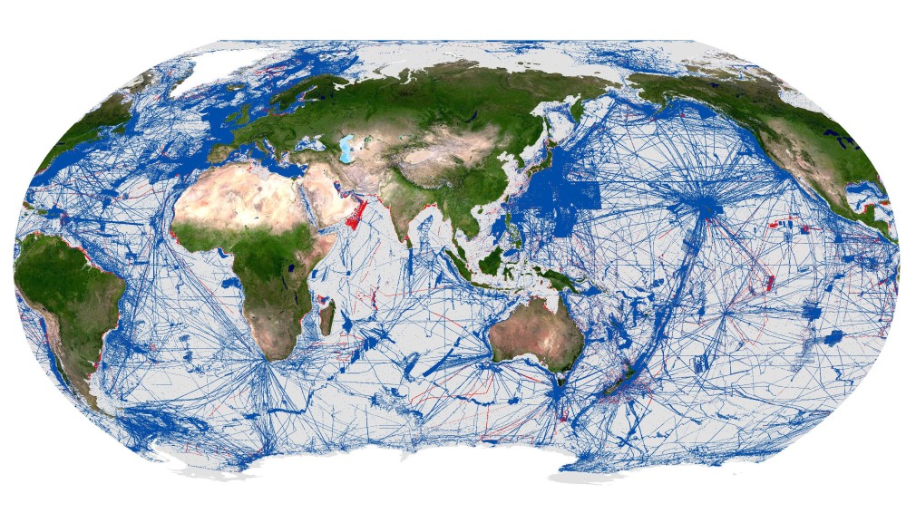
GEBCO_2026 grid - Robinson World Projection - displaying mapped regions in blue. New additions to the GEBCO Grid in the 2026 release highlighted in red.
GEBCO's grids can be downloaded:
- as a global file in netCDF format and as a set of tiles in ASCII and GeoTiff formats
- for user-defined areas, through our download app, in netCDF, data GeoTiff and ESRI ASCII raster formats.
For this release of the GEBCO grid, the data are also available via OPeNDAP – allowing direct access to the data sets through a number of applications.
Find out how to contribute bathymetric data sets to help update the global GEBCO grid.
GEBCO operates under the joint auspices of the International Hydrographic Organization (IHO) and the Intergovernmental Oceanographic Commission (IOC) (of UNESCO). Its mission is to produce free, open and complete seabed data and information for the world’s oceans. This is achieved by enabling and inspiring seabed mapping efforts through international collaboration, technological innovation, capacity development, and education.
Find out more about GEBCO's work and data sets.