

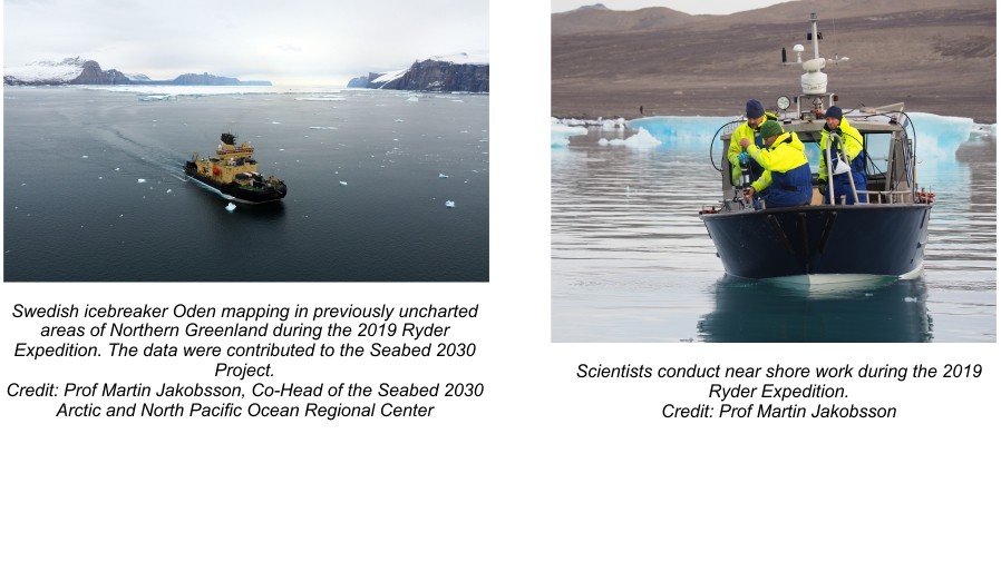
London, 21 June 2020 – On the occasion of World Hydrography Day, The Nippon Foundation-GEBCO Seabed 2030 Project, which aims to facilitate the complete mapping of the global ocean floor by 2030, has announced the inclusion of 14.5 million square kilometres of new bathymetric data in the latest GEBCO Grid. Nearly a fifth of the world’s entire ocean floor has now been mapped, with the new data equating to an area twice the size of Australia.
Coverage of the seabed has risen from 15 per cent to 19 per cent in the last year. When Seabed 2030 was launched in 2017, only six per cent of the oceans had been mapped to modern standards.
The effort to complete the map of the world’s oceans has gathered significant momentum since its launch, with Seabed 2030 rallying over 100 international organisations in support. The Project now has 133 official partners, contributors and supporters – and continues to pursue new collaborations in data collection and technical innovation.
Jamie McMichael-Phillips, Seabed 2030 Project Director, said:
“The sustained increase in data available to map the ocean floor will enable Seabed 2030 to play a leading role in delivering a comprehensive set of authoritative data that is freely available for all to use. This is a leap forward towards achieving our mission, by the year 2030, to empower the world to make policy decisions, use the ocean sustainability and undertake scientific research based on detailed bathymetric information of the Earth’s seabed.
“My thanks go out to all who have contributed data and technical expertise to bring together this new 2020 Grid. With the support of governments, industry, academia and philanthropy; and by using innovative technology, we anticipate availability of new data to grow on a yearly basis.
“It’s encouraging to see what working collaboratively, across the globe, can achieve. Seabed 2030 will continue to seek out new partnerships and technological advancements. Everyone has a part to play in contributing to our ocean mapping journey: a journey that will greatly benefit humanity.”
The Chairman of The Nippon Foundation, Mr Yohei Sasakawa, recently announced three initiatives that need further collaborative activity in accelerating the mapping of the ocean floor – these include supporting the mapping of unexplored areas, collecting data through crowdsourcing, and advancing technology for data collection.
Seabed 2030 continues to act as a catalyst for the unprecedented growth in available bathymetric data. A complete map of the world’s ocean will facilitate a heightened understanding of fundamental processes including ocean circulation, weather systems, sea level rise, tsunami wave propagation, tides, sediment transport, benthic habitat distributions and climate change.
It will also be a key enabler of other deliverables under Sustainable Development Goal 14, to conserve and sustainably use the oceans – all of which echo the goals of the UN Decade of Ocean Science for Sustainable Development.
Notes to Editors
For more detailed information on The Nippon Foundation-GEBCO Seabed 2030 Project, please visit our website, seabed2030.gebco.net, Like our Facebook page, follow us on Twitter @Seabed2030, or contact Jamie McMichael-Phillips on director@seabed2030.org .
For media inquiries, contact:
Patrick Orr
+44 (0)7917 431102
Pegah Souri
+44 (0)7951 581707
About The Nippon Foundation-GEBCO Seabed 2030 Project:
The Nippon Foundation is a private, non-profit foundation established in 1962, in Japan, for the purpose of carrying out philanthropic activities, using revenue from motorboat racing. The Foundation places an emphasis on social innovation, and implementing ideas to bring about change for a better society. Its activities encompass wide-ranging areas such as the fight against leprosy, peacebuilding in Myanmar and passing on the riches of the ocean to the next generation.
The General Bathymetric Chart of the Oceans (GEBCO) is a joint project of the International Hydrographic Organization (IHO) and the Intergovernmental Oceanographic Commission (IOC) of UNESCO – the United Nations Educational Scientific and Cultural Organization. It is the only intergovernmental organisation with a mandate to map the entire ocean floor. It has its origins in the GEBCO chart series initiated in 1903 by Prince Albert I of Monaco, and aims to provide the most authoritative, publicly-available bathymetric datasets for the world’s oceans.
The Nippon Foundation-GEBCO Seabed 2030 Project is a collaborative project between The Nippon Foundation and GEBCO. The Seabed 2030 Project, launched at the United Nations Ocean Conference in 2017 by Chairman Sasakawa of The Nippon Foundation, coordinates and oversees the sourcing and compilation of bathymetric data from different parts of the world’s ocean through its five centres into the freely-available GEBCO Grid. Four Regional Centres cover the Southern Ocean, the Arctic and North Pacific Ocean, the Atlantic and Indian Oceans, and the South and West Pacific Ocean. These feed data products into the Global Data Centre, Southampton.
Find out more about the project and how to get involved.
World Hydrography Day takes place annually on 21 June. This International Day was adopted by the International Hydrographic Organization (IHO) as an annual celebration to publicise the work of hydrographers and the importance of hydrography.