
GEBCO's aim is to produce free, open and complete seabed data and information for the world’s oceans. This is achieved by enabling and inspiring seabed mapping efforts through international collaboration, technological innovation, capacity development, and education.
GEBCO operates under the joint auspices of the International Hydrographic Organization(IHO) and the Intergovernmental Oceanographic Commission (IOC) (of UNESCO).

Organisational structure
We are a non-profit making organisation which relies largely on the voluntary contributions of an enthusiastic international team of geoscientists and hydrographers. GEBCO's work is directed by a Guiding Committee and supported by sub-committees on ocean mapping and undersea feature names plus ad hoc working groups.
These committees meet on a regular basis. Find out more about the people involved in GEBCO and upcoming and previous meetings.
Access the GEBCO Strategy 2024 - 2030 to find out more about GEBCO's vision and mission.
GEBCO Strategy 2024 - 2030 - full resolution (11 MB)
GEBCO Strategy 2024 - 2030 - lower resolution (2 MB)
GEBCO Strategy 2024-2030 - flyer (3.5 MB)
GEBCO has its origins at the beginning of the 20th century. Find out more about GEBCO's history from the initiation of the chart series in 1903 to the present day.
Find out more about GEBCO's work, organisation and the people involved.
Nippon Foundation-GEBCO Seabed 2030 Project
In the opening address of the Forum for Future Ocean Floor Mapping in June 2016, Mr. Sasakawa, Chairman of The Nippon Foundation, set forth the initiative to partner with GEBCO to cooperatively work towards mapping 100% of the topography of the World Ocean by 2030.
This initiative led to the formulation of Nippon Foundation-GEBCO Seabed 2030 Project, a global project within the IHO-IOC GEBCO framework with the focused goal of producing the definitive, high resolution bathymetric map of the entire World Ocean by 2030.
Find out about progress in mapping the global seafloor from Seabed 2030's web site.
Why do we need to map the seafloor and how do we do it?
Knowing the depth and shape of the seafloor is fundamental for understanding ocean circulation, tides, tsunami forecasting, fishing resources, sediment transport, environmental change, underwater geo-hazards, infrastructure construction and maintenance, cable and pipeline routing and much more.
Depths are largely measured using acoustic measuring systems such as multibeam echosounders. Find out more from our Frequestly Asked Questions section.
Outputs from our work
We produce a range of bathymetric data sets and products. This includes global gridded bathymetric data sets; Web Services, the GEBCO Gazetteer of Undersea Feature Names; the GEBCO world map and the IHO-IOC GEBCO Cook Book— a reference manual on how to build bathymetric grids.
Regional mapping
In order to build the next generation of improved GEBCO global bathymetric compilations, regional expertise is needed and this can only be achieved by fully taking advantage of regional seafloor mapping and data collection activities.Through the Sub-Committee on Regional Undersea Mapping (SCRUM), GEBCO is aiming to build on and extend its collaboration with regional mapping groups in order to improve its global bathymetric model.
Find out more about regional mapping projects and GEBCO's collaborations.
Contributing data
GEBCO is continually working to improve its gridded data sets with the aim of providing the most authoritative publicly-available bathymetric grids for the world’s oceans.
We are grateful for contributions of single-beam and/or multibeam survey data, individual soundings or existing grids to help update our gridded data sets and products. We acknowledge the source of contributed data in the documentation which accompanies GEBCO's data sets.
Find out how to contribute data to help update GEBCO's grids.
Crowdsourced bathymetry
Crowdsourced bathymetry (CSB) is the collection of bathymetry data from vessels, using standard navigation instruments, while engaged in routine maritime operations. CSB can be used to supplement the more rigorous and scientific bathymetric coverage done by hydrographic offices, industry, and researchers around the world.
The IHO Inter-Regional Coordinating Committee has established a Crowdsourced Bathymetry Working Group (CSBWG) to examine how best to incorporate, manage and use bathymetric data collected by other than conventional means.
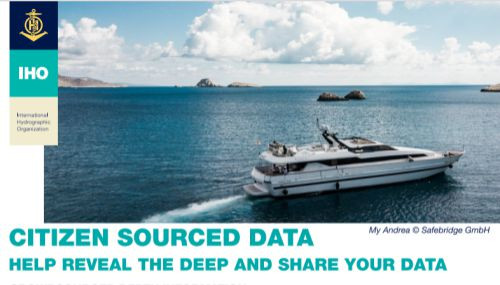
Find out how you can get involved through the CSB information leaflets on the IHO's web site.
Find out more about the IHO Crowdsourced Bathymetry Initiative from the IHO DCDB's web site.
Training a new generation of scientists
The Nippon Foundation of Japan has provided funding for GEBCO to train a new generation of scientists and hydrographers in ocean bathymetry. The 12-month course, leading to a Postgraduate Certificate in Ocean Bathymetry (PCOB), has been held at the University of New Hampshire, USA since 2004.
Hear about the perspectives of the impact of the programme from GEBCO colleagues and scholars.
Find out more
To find out more about our work and to get involved in GEBCO please contact us.